Introduction
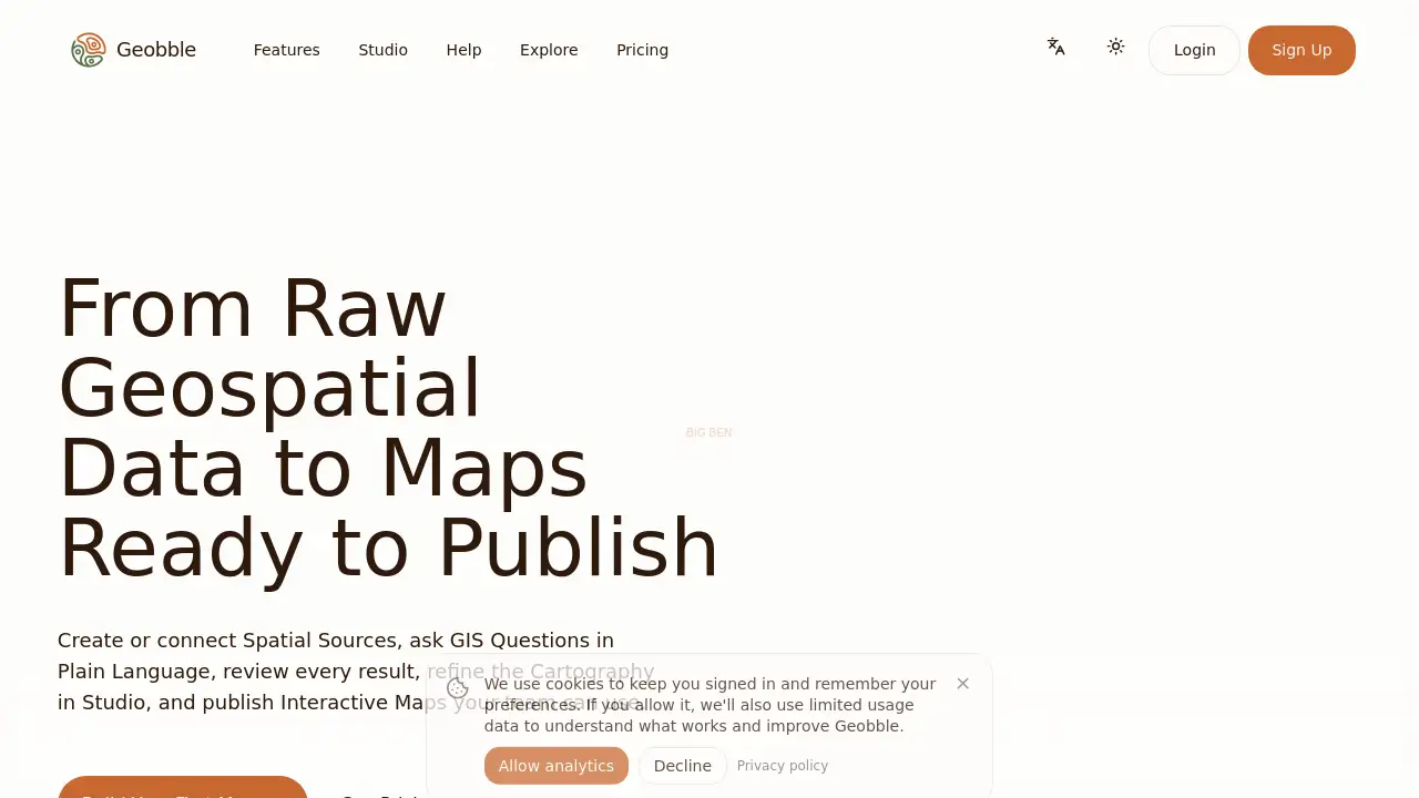
Geobble is an AI GIS platform for interactive maps. It brings data import, spatial analysis, cartography, collaboration, and map publishing into one reviewable workflow. This Geobble review explains what the platform does, who it suits, and how teams can use it.
What is Geobble?
Geobble is a web-based geospatial workflow platform designed to turn raw GIS data into maps ready to publish. It helps users import standard GIS files or connect PostGIS data, ask spatial questions in plain language, generate map symbology, collaborate in Studio, and publish interactive maps. The platform solves a common problem: geospatial work is often split across separate tools for data preparation, spatial analysis, cartography, and sharing. Geobble brings these steps into one reviewable environment.
It is suitable for GIS specialists, analysts, planners, researchers, and stakeholders who need to move from a spatial question to a usable map. Instead of treating AI as a black box, Geobble lets users inspect operations, correct uncertain results, and refine the final cartography. That makes it useful for teams that want AI speed without giving up control over GIS data, map design, or publishing access.
Key Features of Geobble
Plain-Language Spatial Analysis
Geobble lets users ask spatial questions in natural language. It can generate filters, joins, buffers, intersections, proximity searches, summaries, and comparisons without requiring every query to be written from scratch.
AI-Assisted Map Symbology
The platform generates classifications, palettes, labels, legends, and zoom-aware styles from spatial data. Users can then refine these choices directly in Studio for a more polished cartographic result.
File and PostGIS Data Import
Users can upload standard GIS files, connect PostGIS tables, extract geographic features from evidence, or enrich existing sources. Geobble supports a practical GIS workflow that starts from familiar data formats.
Reviewable AI Workflow
Geobble keeps sources, operations, styles, and published results open to inspection. Users can review what changed, correct uncertain outputs, and decide what is applied or published.
Collaborative Studio Editing
Studio gives teams direct control over cartography and final map experience. GIS specialists can work with precision while analysts, planners, and stakeholders share the same map context.
Controlled Publishing and Sharing
Geobble supports private maps, selected collaborators, public sharing, and embedded outputs. This makes interactive map publishing useful for internal decisions, client work, and public communication.
Open Geospatial Stack Support
Geobble works with standard GIS files and PostGIS, exports portable formats, and publishes web maps on foundations such as MapLibre, DuckDB, GeoParquet, and PMTiles. This helps teams fit Geobble into existing geospatial data workflows.
Use Cases for Geobble
Planning and Public Communication
Turn zoning, parcels, transport, amenities, and public records into maps people can inspect and discuss. Geobble helps planning teams present spatial analysis in a clearer, interactive format.
Environmental and Climate Work
Combine hazard, land-use, hydrology, field, and monitoring sources into reviewable analysis and readable maps. The platform supports environmental teams that need to compare place-based data over time.
Infrastructure and Accessibility
Analyze networks, proximity, service areas, routes, and project impacts with spatial tools that preserve working context. Geobble can help infrastructure teams measure access and communicate findings.
Site Selection and Place Comparison
Compare parcels, demographics, amenities, constraints, and access in interactive decision maps. Users can ask spatial questions and refine results before sharing them with decision-makers.
Shared Geospatial Knowledge
Organize reusable sources, collections, maps, themes, and symbol sets with clear ownership and access. This supports teams that want a more consistent GIS workflow across projects.
Client and Stakeholder Deliverables
Move from analysis to a polished interactive result without reducing the work to static screenshots. Geobble is useful for consultants and teams that need client-ready map publishing.
How to Use Geobble
- Create or connect a source. Upload GIS files, import PostGIS tables, extract geographic features, or enrich an existing source.
- Ask a spatial question in plain language. Use Geobble to filter, join, buffer, intersect, summarize, compare places, or measure access.
- Review AI-assisted results. Inspect operations, correct uncertain outputs, and decide what should be kept.
- Refine cartography in Studio. Adjust symbology, labels, legends, popups, layer visibility, groups, and zoom ranges.
- Publish an interactive map. Keep it private, share it with selected collaborators, or make it public for wider use.
Target Audience for Geobble
- GIS specialists and geospatial analysts
- Urban planners and public sector teams
- Environmental and climate researchers
- Infrastructure and accessibility teams
- Consultants and client-facing mapping teams
- Analysts, planners, researchers, and stakeholders who need map context
Is Geobble Free?
The provided information includes a Pricing page and a Sign Up option, but exact plan prices are not listed. Users should check the official pricing page at geobble.com/pricing for current details.
| Plan | Price | Features |
|---|---|---|
| Free or Trial | Not confirmed in provided information | Check official pricing page |
| Paid Plans | Not listed in provided information | Projects, Studio, collaboration, publishing features |
A free or trial option may be available, but the reference content does not confirm it. The safest step is to visit the official pricing page before choosing a plan.
Geobble's Pros and Cons
| Aspect | Pros | Cons |
|---|---|---|
| Pricing | Official pricing page is available | Exact costs are not listed in provided information |
| Features | AI spatial analysis, Studio cartography, PostGIS import, interactive publishing | AI results should be reviewed before publication |
| Workflow | One reviewable workflow from source data to map | May require time to learn for non-GIS users |
| Collaboration | Mixed technical and domain teams can share map context | Advanced cartography may still need GIS experience |
| Publishing | Private, shared, public, and embedded output options | Access settings need careful planning |
Frequently Asked Questions about Geobble
What is Geobble used for?
Geobble is used to import or connect GIS data, ask spatial questions, generate map symbology, collaborate in Studio, and publish interactive maps. It is an AI GIS platform for teams that need analysis to become a usable map.
Does Geobble support PostGIS?
Yes. Geobble can import PostGIS tables and work with standard GIS files. This helps teams keep spatial analysis connected to existing databases and geospatial workflows.
Can Geobble create interactive maps?
Yes. Geobble is built for interactive map publishing. Users can keep maps private, share them with selected collaborators, or make finished maps public.
Is Geobble suitable for non-GIS users?
Geobble is designed for mixed teams. Analysts, planners, researchers, and stakeholders can ask spatial questions in plain language, while GIS specialists retain direct control in Studio.
Can users collaborate in Geobble?
Yes. Studio supports collaborative editing and review. Teams can work from the same map context and refine data, cartography, and interaction details together.
Does Geobble use AI for spatial analysis?
Yes. Geobble uses AI assistance for plain-language GIS questions, analysis layers, and first cartographic drafts. Results remain reviewable and editable, so users can inspect and correct the work.
Geobble Tags
Geobble, AI GIS platform, spatial analysis tool, interactive map publishing, PostGIS mapping, GIS workflow, geospatial data analysis, cartography software, map collaboration, GIS data import, web map publishing, location intelligence